Daylight Saving Time begins Sunday, leading to a week of variable weather patterns. High pressure expected this weekend gives way to windy and rainy conditions from Monday through Friday, including a strong storm system bringing heavy rainfall and cooler temperatures. A total lunar eclipse will occur late Thursday. The weekend following this turbulent weather is expected to be dry and warm.
This week, Daylight Saving Time commences on Sunday, prompting the clocks to “spring forward” one hour at 2 a.m., resulting in both later sunsets and reduced sleep in the mornings. A dynamic weather pattern is anticipated, starting with dry conditions this weekend before transitioning to rain and wind from Monday to Friday morning.
This weekend, high pressure will provide clear weather, while gentle to moderate Santa Lucia winds (8-18 mph) develop in the mornings and evenings. Expect chilly mornings and mild afternoons, with patches of marine low clouds along the coast during the afternoons and evenings.
An upper-level low-pressure system north of the Central Coast will shift southeast on Monday, generating fresh to strong southerly winds (19-31 mph) and possible scattered rain showers late Monday into Tuesday morning. While Southern California may experience heavier rain, totals near the Central Coast will likely remain below 0.10 of an inch.
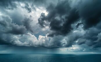
Morning temperatures will range from the mid to upper 30s in inland valleys and low 40s along the coast, with daytime highs in the mid-60s from Sunday to Tuesday. A stronger storm system is expected to arrive on Wednesday, with a cold front bringing periods of heavy rain and gale-force winds.
As the cold front moves through, expect gusts up to 46 mph and rainfall totals between 1 to 2 inches from Wednesday to Friday morning, particularly in the coastal mountains. The transition from the storm will bring colder weather, with highs struggling to reach the mid-50s and snow levels dropping to 3,500 feet.
Additionally, a total lunar eclipse will occur late Thursday night into early Friday morning, potentially visible during brief breaks in the rain. Beginning at 8:57 p.m., totality will last from 11:26 p.m. to 12:31 a.m. PDT, resulting in a coppery hue of the Moon due to atmospheric filtering.
Following this week of varied weather, a high-pressure ridge is forecast for next weekend, bringing drier and warmer conditions. Except for a minor chance of rain on Monday, the Central Coast should remain dry through the subsequent week.
The surf forecast predicts a 5- to 7-foot northwesterly swell, increasing to 6- to 8-feet on Monday and Tuesday. Southern California will experience mixed waves, with moderately sized swells persisting into the weekend. Surface seawater temperatures will remain between 52 and 53 degrees.
In historical weather records, notable events occurred on March 2, including record snowfall in Washington in 1956 and severe thunderstorms in Texas in 1990, showcasing the variability and extremes of weather across different regions.
This week’s weather report highlights the onset of Daylight Saving Time, with significant changes in weather patterns, including winds and rain expected from Monday through Friday. A stronger storm system is predicted to bring heavy rainfall and cooler temperatures mid-week, while a total lunar eclipse will grace the night sky. Following this weather fluctuation, a stable high-pressure system is anticipated, promoting drier and warmer conditions for the following week.
Original Source: santamariatimes.com