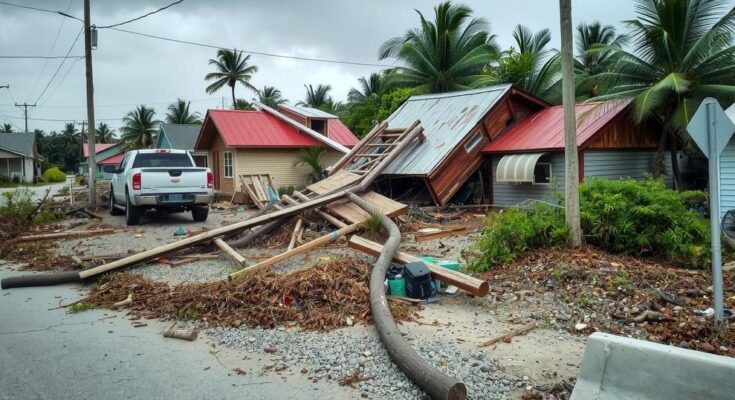
Cyclone Chido wreaked havoc on Mayotte on December 14, 2024, leaving a trail of destruction that included uprooted trees, downed utility lines, and damaged infrastructure. The cyclone’s impact was particularly evident in satellite images comparing the lush landscape prior to the storm to the affected areas afterward. The event raises concerns about food supply and community resilience in the face of such disasters.
On December 14, 2024, Cyclone Chido ravaged the islands of Mayotte, causing extensive devastation. The cyclone, categorized as equivalent to a Category 4 hurricane, unleashed hurricane-force winds, uprooting trees, downing utility poles, and stripping roofs from homes. Satellite images captured the stark transformation of the landscape, with lush greenery replaced by brown desolation, particularly evident on the main island, Grande Terre.
Professor Jess Zimmerman from the University of Puerto Rico has examined the effects of hurricanes on tree composition and observed similar devastation from tropical cyclones in the southwest Indian Ocean. Following a review of the satellite images, he highlighted significant damage to vegetation on the hillsides near Mamoudzou, the capital city of Mayotte.
The wind’s intensity not only stripped leaves and snapped branches but also facilitated tree uprooting due to saturated soils. Trees positioned at high elevations or on steep slopes inherently face greater vulnerability, as they are directly exposed to elevated wind speeds.
The extent of destruction was underscored by reports from Agence France-Presse detailing the collapse of a 300-year-old giant baobab tree onto a restaurant. Additionally, the storm uprooted an acacia tree, leaving a three-meter mound of soil in its place. Vital crops such as banana trees were lost, jeopardizing the food supply for island communities.
Beyond the ecological impact, Cyclone Chido severely affected the island’s infrastructure, damaging the airport, hospitals, and roads, which hindered access to essential services such as electricity and water. Satellite assessments from the European Commission indicated that much of the destruction occurred in the northeast region, where the cyclone initially struck Grande Terre.
The fallout from Cyclone Chido illustrates not only the immediate physical destruction wrought by such storms but also the longer-term implications for the environment and livelihoods in Mayotte.
Cyclone Chido’s impact on Mayotte was significant given the island’s geographical location in the southwest Indian Ocean, which is susceptible to tropical storms. This cyclone, equivalent to a strong Category 4 hurricane, struck the islands with high winds and heavy rains, leading to considerable damage to both the natural landscape and critical infrastructure. Understanding the vulnerability of certain tree species and the landscape can provide insight into the ecological ramifications of such natural disasters.
In conclusion, Cyclone Chido has profoundly affected Mayotte, resulting in severe environmental and infrastructural damage. The altered landscape is a testament to the cyclone’s destructive power, with significant implications for local vegetation and food supplies. The devastation also highlights the challenges faced by communities in the wake of such natural disasters, reinforcing the need for ongoing assessment and response strategies.
Original Source: earthobservatory.nasa.gov


